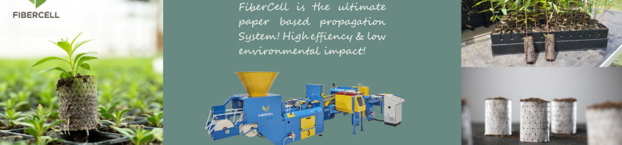


Background
The STA Explorer introduced a practical way to map operational tree-planting activities at scale - STA Explorer Set for Release: Smarter Tree Planting | Forsilvitech. The STA Explorer HA represents a significant advancement in the monitoring and management of tree-planting operations. Leveraging field-collected spatial data, it enables forestry companies to map and visualise planting activities at an operational scale. Unlike traditional approaches that rely primarily on contractor reports, stand summaries, or sample-based assessments, the STA Explorer HA enables users to gain a comprehensive view of planting coverage, stocking density, operational patterns, and unplanted areas in near real time. This enhanced level of visibility can support improved quality control, operational efficiency, and data-driven decision-making throughout the plantation establishment process.
How does it work
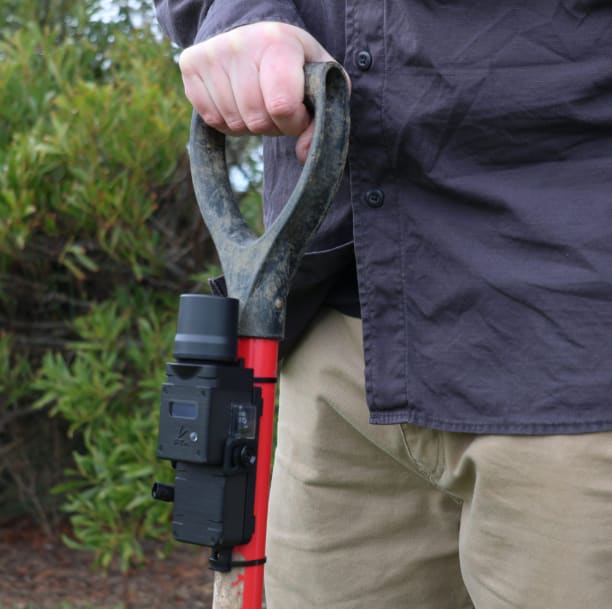
The STA Explorer HA (High Accuracy) is a precision forestry tool designed to record the location of individual trees during planting operations automatically. Mounted directly onto a planting tool, such as a pottiputki, dibble bar, or planting shovel, the device uses built-in sensors and GPS technology to detect each planting action and record its exact location. When a tree is planted, the device captures the GPS coordinates and stores the data, which can later be uploaded to a cloud-based platform for analysis and reporting. The STA Explorer HA builds on the capability by introducing high-accuracy GNSS workflows and post-processed positioning into the planting process. This opens the door to much more detailed spatial analysis, including highly accurate stem-level locations, planting line assessments, survival monitoring, and integration with other precision forestry datasets. Importantly, the STA Explorer HA retains the same simple field workflow as the standard STA Explorer. From an operational perspective, the device is used in much the same way, with additional precision achieved through post-processing workflows following field collection. The STA Explorer HA uses Post-Processed Kinematic (PPK) positioning. Unlike real-time correction systems, PPK processing is performed after field data collection and relies on access to suitable base station data recorded during the same time as the field work.
Accuracy in tree planting locations
The practical outcome of this workflow is that planting data can move beyond operational summaries and into genuinely spatial forestry datasets. Instead of simply understanding how many trees were planted in an area, forest companies can begin analysing where individual trees were planted, how planting lines behave spatially across terrain, spacing consistency, long-term survival trends, or interactions with other environmental datasets. This can be used by companies for day-to-day operational tracking.
For more information, visit: Stalogger.com


