

Application of GPS in forestry
Forestry, and especially silviculture, often borrows concepts from agriculture. Precision forestry is no exception. In precision agriculture, the idea is to allocate the right resources in the right amount at the right time and place. Precision agriculture uses precise systems for geopositioning, which use RTK and satellite technology to achieve centimetre-level precision. With RTK you need a subscription and a mobile network. Without a mobile network or satellite internet, you often have to fall back on satellite technology and service, which can be cost-prohibitive in some silviculture settings. However, corrected GPS positioning can be overkill in some situations. If the aim is to achieve accuracy in stocking, the correct stems per hectare, then a more cost-effective GPS solution will suffice. Dedicated GPS chips have good precision in clear-fell areas - as opposed to mobile phone chipsets that also suffer from being placed sub-optimally from a precision point of view due to space constraints in the phone.
Cost effective solution
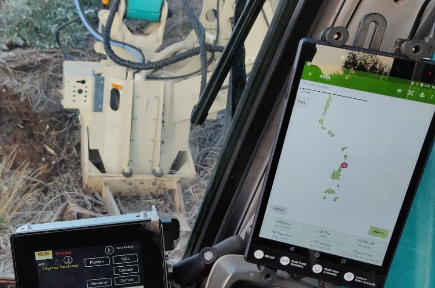
Not all precision forestry implementations can leverage basic GPS technology and therefore do require more precision in terms of geolocation. Nonetheless, with a GPS solution and the right software you can integrate grids with varying geometries and adjustable sizes, sub-stand areas for precise and varying stocking levels, implementation and monitoring of hazards and so on. The practical implementation of silvicultural plans can be done using an affordable precision forestry solution that serves to democratize these tools for all contractors. A viable solution to consider is the Risutec ASTA for contractors. It can cost effectively be used to report and show the seedling or pit locations, areas, planting densities, and planting productivity in real time. Furthermore, it can be used to document the areas that have been cleared when it comes to tending operations.
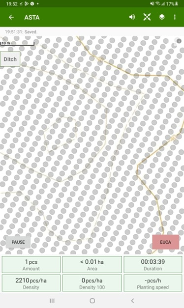
The ASTA for Contractors model is integrated to your excavators joystick. It can be pre-programed so that buttons used regularly can be selected easily for effective operation. ASTA is built on Android and is available in the Google Play Store for convenient downloading. It enables an overlay of in-field results on your preferred map for reporting and research. Furthermore, the contractor can study effects systematically to gain an understanding over the optimal silvicultural inputs. Below is an image of ASTA for contracting with a shapefile grid - overlay created in QGIS. The geometry can be chosen, but with a “point type”- grid you can set the size of points and transparency to suit your needs.
For more information visit: Risutec


